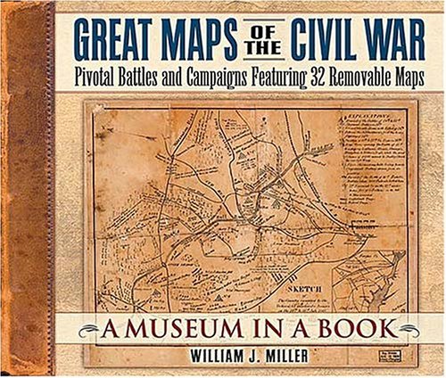
When Union General George McClellan marched toward the Confederate capital of Richmond in 1862, he encountered the Warwick River where it wasnt supposed to be, causing a delay in his strategy and criticism from Northern press. McClellan was following a map created by an esteemed and experienced topographer, but the map was wrong! The map McClellan was following, reproduced in Great Maps of the Civil War, shows lines in pencil along the true course of the Warwick, apparently drawn after it was too late. Most people interested in the Civil War are fascinated by maps for what they tell about the battles, for what they tell about the terrain, and in some cases for their artistic beauty. But maps reproduced in books have limitations and there is not a good way of preserving a map collection until now. Fifteen chapters in Great Maps of the Civil War each contain two or three maps that can be pulled out of a pocket. Ten of the maps are 18 x 24; others are smaller. In addition to a discussion of the battles and the roles of the maps, the book tells about Civil War mapmakers and the methods they used. Stunningly designed, this unique full-color book will make a significant addition to the library of any Civil War enthusiast or those who are fascinated by maps and mapmakers.
Authors
William Miller
Additional Info
- Release Date: 2004-10-21
- Publisher: Thomas Nelson
- Format: Hardcover
- ISBN: 9781558539990
No copies of this item are currently available.